
Where is the Western Wake Area Plan?
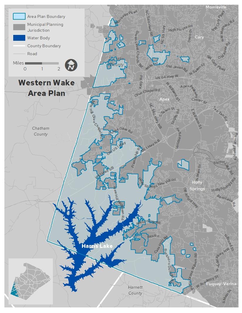
The Western Wake (WW) Area Plan includes about 44 square miles, or 28,100 acres located in the southwest area of Wake County, bordered by Chatham and Harnett County. Click below to see this area on a map.
View the Western Wake Area Plan Map
What is the Western Wake Area Plan?
The Western Wake (WW) Area Plan is a component of Wake County’s new comprehensive plan, PLANWake, adopted in April 2021. The area plans separate the county into seven distinct areas for more localized planning with community input. The WW Area Plan will be the fourth area to undergo the process of determining what type of built environment – the homes, buildings, streets, open spaces, farms, and infrastructure – is envisioned for the future at the local level.
Get Involved

If you live in this community (or even if you don't!) and want to help shape it for the future, you're invited to participate. Wake County staff needs to hear from you as the Western Wake Area Plan is drafted over the next several months.
Input and participation from our diverse population are vital for any planning process to be considered successful. Insight from those who live, work and play in this area will drive planning projects that are developed with the specific community’s needs and desires, as well as their vision for the future, in mind. Share experiences, preferences and other feedback to help us why you love where you live and what you’d like to see more of.
Check out the engagement opportunities below.
We recommend you progress through the cards below in order. Start by reading the draft plan and then review the draft map, where you can provide site-specific feedback. Finally, fill out the form to let us know how we are doing.


Related Projects
The following projects are ongoing in the study area.
Western Big Branch Area Plan
The Town of Apex is updating long-range plans for an area which is historically part of the Friendship and New Hill communities.
2040 Comprehensive Transportation Plan
The Town of Fuquay-Varina recently kicked off the development of their 2040 Comprehensive Transportation Plan (CTP). The CTP will identify improvements for all modes of transportation and create recommendations that efficiently and effectively move vehicles, pedestrians, bicyclists, and transit riders through Town.
Complete 540
This major project in the study area would extend NC-540, a 6-lane toll road, from I-40 to I-87 and I-540 in Knightdale. This project is expected to be open to traffic by 2028.
Timeline
Updates with specific dates and times will be posted on this page. You can also sign-up below to receive emails with more detailed project updates.

Plan Kickoff
April 2024
Public Engagement:
Ongoing
Draft Plan
Late summer 2024
Plan Proposal
Late fall 2024
Contact Us With Questions
areaplan@wake.gov
919-856-6310, press 8