Where is the Lower Neuse Area Plan?
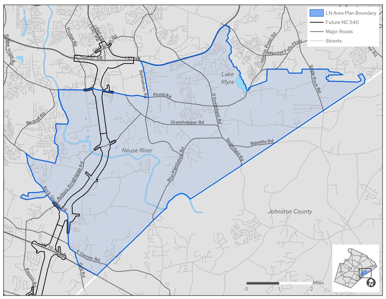
The Lower Neuse (LN) Area Plan includes about 32 square miles, or 20,500 acres located near the lower Neuse River on the eastern county limits extending from the edge of Raleigh to the boundary with Johnston County. Click below to see this area on a map.
View the Lower Neuse Area Plan Map
What is the Lower Neuse Area Plan?

The Lower Neuse (LN) Area Plan was approved by the Wake County Board of Commissioners on April 1, 2024.
Input and participation from our diverse population were vital in the planning process. Thank you to everyone who provided insight into the community’s needs and vision for the future.
View the adopted plan below or review past engagement opportunities.


Background Information
Below you'll find a story map that is intended to present information and context about the Lower Neuse area. Click on the link to open the story map and scroll down to see all seven maps. Each map is expandable by clicking on the double arrows in the upper right-hand corner, and users can explore the maps in greater detail by using the "+" and "-" symbols to zoom in and out. As you zoom in more information becomes available. Users can also find their location on the map by clicking on the arrow.
View the Story MapContact Us With Questions
areaplan@wake.gov
919-856-6310, press 8